Note: This new functionality requires first upgrading to the New Look for StudyStays. Please contact support@studystays.com if you'd like to upgrade.
Listing maps now include a new way to quickly look up directions to a campus.

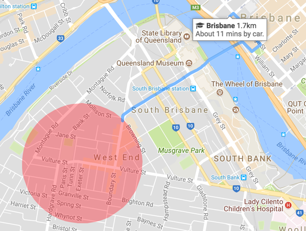
Hovering or clicking (or tapping on mobile) on a campus in the listing map will load a route and approximate driving time to the campus.
For listings that are within 1 kilometre of a campus, walking directions will be shown instead.
Does this keep addresses private?
As you're probably aware, some listings don't show the exact address; either because the admin settings require it, or the provider has chosen to keep their address private, or the user is not registered as a student.
In these cases, the blue line showing the route to campus begins just within the red circle showing the approximate location of the listing. The travel time shown is still the approximate travel time for the entire route.
More map tweaks
Initially with the New Look, maps would all display at the same zoom level. This zoom level would often not show a campus. Now maps are automatically zoomed to the level that will show the nearest campus, while still keeping the map centred on the listing.
Arrows for campus markers are now displayed at the top of the marker instead of the bottom. This allows the marker text to expand downwards to show directions without changing the location pointed to.